Methods
Project Design and Methods
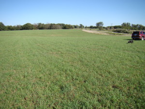
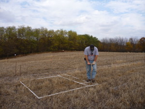
The Prairies For Agriculture Project is located in Marion County, Iowa, on an upland site between the cities of Pella and Knoxville. The property has poor to moderate quality soils and previously was used for crop production followed by hay production, most recently being planted to orchard grass, alfalfa, and Kentucky blue grass. Our 14 acre site has been divided into 378 plots, each measuring 9 x 9 meters and surrounded on all sides by a two meter wide, mowed buffer.
Plots were randomly assigned a vegetation mix, and planting began in fall of 2011; the majority of plots were planted in spring of 2012. Some plots are planted with a single species while others contain 4, 8, 16, 24, 32, 40, 48, 56, or 64 species. Each mix type is replicated on three plots; therefore, the whole site contains approximately 125 different mixes of plants. Single species plots include the dominant prairie grasses as well as the Eurasian grass commonly planted on farms, smooth brome, for direct comparison. The diverse mixes of plants include many different combinations of cool-season grasses*, warm-season grasses, nitrogen-fixing legumes, and other prairie forbs**, in addition to several combinations of non-native plants commonly used by agricultural producers for comparison. (*Cool-season grasses, like prairie junegrass, become active early in spring, produce seeds, and become dormant by the heat of summer; warm-season grasses, like big bluestem, shift their activity later in the year. ** A forb is any non-woody plant that is not a grass or grass-relative; in simple terms, the plants with showy flowers in a prairie are forbs.)
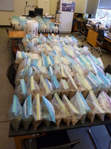
We purchased seeds for our project from two local seed companies. We used native-ecotype seeds, meaning they were collected from locations close to our research site. (In this case, seeds used by the seed company to start their production plots were all collected from remnant prairies in central Iowa.) Species were selected that are native to upland prairies in Marion County; other selection criteria included availability from dealers and seed cost. Additionally, plants were chosen to include representatives from as many different plant families as possible. Each plot was planted with the same total number of seeds, numbering 50 per square foot (538 / meter2) as recommended by Smith et al.14 In those plots that contain both grasses and forbs, the 50 seeds per square foot were divided equally between forbs (25 seeds) and grasses (25 seeds). In those plots that contain more than one species, the seeds were divided equally by the number of species. Therefore, a plot that contained five species of grasses and 10 species of forbs would have five seeds per square foot per species for the grasses (25 seeds divided by five species) and 2.5 seeds per species for forbs (25 seeds divided by ten species). Seeds were purchased in spring of 2011 and stored in cool dry conditions until fall of 2012 (seeds had been harvested by the seed companies in summer and fall of 2010). Those seeds to be planted in spring of 2012 were mixed with moist sand and stored in a refrigerator for five weeks prior to planting, as recommended by Smith et al.14
In the year leading up to planting, the corners of each plot were marked with pieces of re-bar, existing vegetation was sprayed with herbicide several times, and the plots were tilled using a hand-tiller and a tractor-powered rotary tiller. During planting, seeds were broadcast by hand, plots were lightly raked with hand-held tools, and the soil was compacted using a rolling compactor pulled behind a lawn tractor. During the first summer of growth (2012), plots were mowed once every couple of weeks, as the height of plants reached approximately 18” tall (45 cm) as recommended by Smith et al.14 and other prairie planting literature. This is done to reduce the height of annual weeds which typically explode in numbers and compete with seedlings of prairie plants. Additionally, we spent considerable time during the first two years controlling invasive species by pulling (Queen Anne’s lace, yellow and white sweet clover, bird’s foot trefoil), cutting (wild parsnip, yellow sweet clover), or spraying (several thistle species).
Biomass will be quantified by cutting strips of a constant size (1/2 meter by two meters) through each plot, drying, and weighing the vegetation. To assess animal use of different plantings, we will focus on several insect groups (butterflies, bees, wasps, etc.), foraging by deer and small mammals, and foraging by birds, using commonly-used trapping or observational techniques. To evaluate soil chemistry, we will focus on sequestration of carbon and storage of nitrogen and phosphorus. Soil chemistry will be measured using standard techniques conducted by licensed and reputable labs. Baseline soil samples were taken from 195 plots prior to planting and already have been analyzed by the Soil and Plant Analysis Lab at Iowa State University. Soil erosion likely will be monitored in one of two ways. We will use either silt fences to trap and quantify eroded soil or spread tracer substances on the soil and measure their loss.
Forage production likely will be an important benefit of planting diverse mixes of prairie vegetation. The biomass measurements described above also will allow us to test forage production of many different mixes of prairie plants. Forage quality can be assessed using standard chemical analysis of fiber, crude protein, and mineral content; we will use these methods to test many different species as well as to assess the quality of important forage plants when grown with different combinations of legumes and forbs.
Clearly, we have enough research questions for years of work. The prairie vegetation we are establishing will persist for decades, and this project is intended to continue for at least 15 to 20 years, allowing time to address these questions.
From an educational perspective, we are designing our site with education/demonstration as one of the primary goals. We already have a classroom/office on site which will be ideal for presentations, orientations, and meetings. In addition, plots will be individually marked, and interpretive signs will be created so that un-guided visitors can learn about our project. Most importantly, we will coordinate with local schools, nature groups, the NRCS office (5 miles away), and state and county Farm Bureau chapters to offer guided visits.


